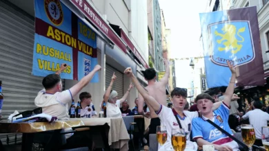
Jubilee Gardens in Mortlake is a busy park on one day each year. For the remaining 364, this rectangular pocket of grass and trees, situated roughly halfway between Chiswick and Barnes bridges, is a fairly ordinary patch of green. But on the afternoon of the Oxford and Cambridge Boat Race, it becomes one of the best vantage points on the Thames, as the finish line lies just before Chiswick Bridge, directly in front of the park. The women’s race typically starts around 2.21pm, the men’s at 3.21pm, and spectators heading to the park are advised that Barnes Bridge and Mortlake stations on South Western Railway offer the nearest rail access.
A day of crowds
The park’s appeal on race day is straightforward: a clear view of the final stretch of the 4-mile-374-yard Championship Course, which has been used since 1845. Cambridge holds the fastest men’s time of 16 minutes 19 seconds, set in 1998, and the fastest women’s time of 18 minutes 33 seconds, set in 2017. The race has not always passed without incident — sinkings occurred in 1859, 1925, 1951, 1978 (Cambridge) and 1912 (both boats), and in 2012 the men’s race was stopped when a swimmer entered the river. The Ship pub near the finish line serves as a gathering point for the crowd, and the Thames Path along the Mortlake bank offers additional access, though it can be wet underfoot.
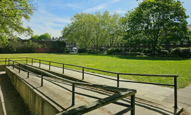
Beyond the Boat Race, Jubilee Gardens serves a quieter but essential function: it provides one of the few step-free points of access to the riverside in the area. A concrete slope, added when the park was first laid out, allows wheelchair users, pushchairs and anyone who struggles with steps to reach the riverbank. That amenity is especially valuable given the industrial history of Mortlake’s riverfront, which over the centuries hosted tapestry works (from 1617 to 1704), sugar houses, malt houses, potteries and breweries, including the former Stag Brewery — all of which left a legacy of enclosed wharves and staircases rather than open, level access.
From private garden to public space
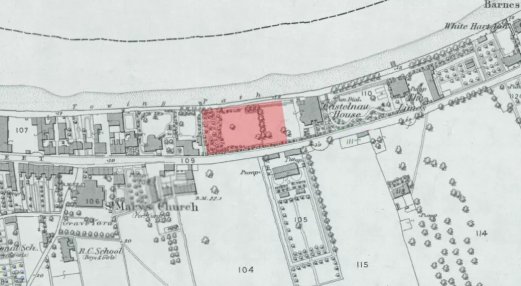
The story of Jubilee Gardens begins with a private garden. In the 1840s, Major Charles Lestock Boileau, a descendant of Huguenot refugees who had fled France for England and settled in Mortlake, built Castelnau House on the site. He named the house after his family’s ancestral estate, Castelnau de la Garde, near Nîmes in France. Major Boileau had served in the Rifle Brigade and spent part of his military career in India; he was married three times. He also acquired land on both sides of the newly constructed Upper Bridge Road (later renamed Castelnau) and developed villas there during the 1840s. The house itself occupied a large plot beside the Thames, with a garden that extended to the river.
That tranquillity did not last. The neighbouring property was cleared to make way for an early electricity-generating plant — the Barnes Electricity Works, built by the Barnes Urban District Council. The council had applied for an order to generate and supply electricity in 1898, and the power station, constructed on Mortlake High Street, first supplied current in May 1901. It continued operating until its decommissioning in 1959. (The broader context of electricity supply in the UK saw the first public generator in Godalming, Surrey, in 1881; the Electricity Supply Act of 1926 coordinated the system into a national grid; and by 1920 London alone had over 50 different supply networks.) The presence of the power station, with its coal bunkers and chimneys, must have diminished the charm of Castelnau House.
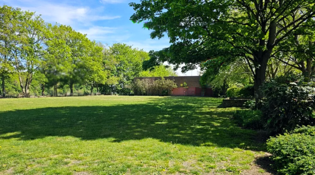
Some historical accounts suggest Castelnau House may have been demolished earlier than the commonly cited date, possibly in 1907, when it is said to have been known as Tower House. The original article, however, states that the house was demolished in the early 1960s. What is certain is that the land was then requisitioned by the council for use as a depot yard. The plot where the house had stood became a coal bunker — an ignoble end for a villa built by a Huguenot family. The council vacated the site barely a decade later, and about two-thirds of it was then laid out as a public garden. Various names were suggested, but the public opted to call it Jubilee Gardens in celebration of the Queen’s Silver Jubilee in 1977. The remaining third of the site was retained by the surviving elements of the old electricity plant, which continue to operate as a substation hidden behind brick walls. (After decommissioning, the main power station buildings were also retained; they now house the Old Power Station, containing a youth centre and offices.)
The transformation from a private garden to a council depot to a public park mirrors broader trends in UK public park development. Many public parks originated in the Victorian era as a response to industrialisation and urbanisation, but the post-war period saw local authorities take on a central role in managing green spaces. By the 1970s and 1980s, funding for parks declined, leaving some to become run-down or sites of antisocial behaviour. Jubilee Gardens itself was created at the tail end of that era, but its riverside location and role as a Boat Race viewpoint have kept it in regular use.
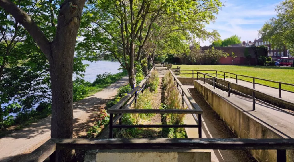
A modest pocket park
Jubilee Gardens is not a large or ornate park. It is a rectangle of lawn with trees planted on two sides and a pavement around the edges. Candidly, history aside, the park is not hugely interesting as a landscape. Yet it contains one quirk: on OpenStreetMap, the online mapping platform, it is labelled “Dovecote Gardens”. A dovecote is a structure for housing doves or pigeons, and there is a street named Dovecote Gardens in the Mortlake area, but the reason for the misnomer on the map is unclear. It may be an error or a historical local name that has not gained wider recognition.
For the other 364 days, Jubilee Gardens remains a modest pocket park — a rectangle of grass and trees with a concrete ramp to the water, a substation behind brick walls, and a view of the Thames that, once a year, draws a crowd.