New analysis of Japan’s catastrophic 2011 tsunami has revealed a critical, overlooked factor that dramatically amplified its destructive power: the mud-rich nature of the coastline it engulfed.
The research, led by Patrick Sharrocks from the University of Leeds and published in the Journal of the Geological Society, shows that as the towering wave swept inland over rice paddies and saturated ground, it underwent a deadly transformation. What began as a fast-moving, clear-water flow rapidly became a thick, viscous, mud-laden torrent.
How Mud Turned a Wave into a Wrecking Ball
This shift was not merely cosmetic. The study, which utilized helicopter video footage and Google Earth imagery to reconstruct the tsunami’s speed, shape, and power, explains that a dense, mud-rich flow exerts considerably more force than clear water. The added mass and thickness of the sediment-laden wave acted like a bulldozer, delivering a more powerful impact to buildings and infrastructure in its path, directly contributing to greater damage and a higher incidence of injuries and fatalities.
Sharrocks’ team describes the phenomenon as similar to the destructive lahars—mudflows—that form on volcanoes when water mixes with loose sediment. This understanding of flow transformations is a key focus of Sharrocks’ PhD research at Leeds, funded by the PANORAMA DTP, which aims to decode the complex processes within tsunamis to better quantify their hazards.
Context of a Catastrophe
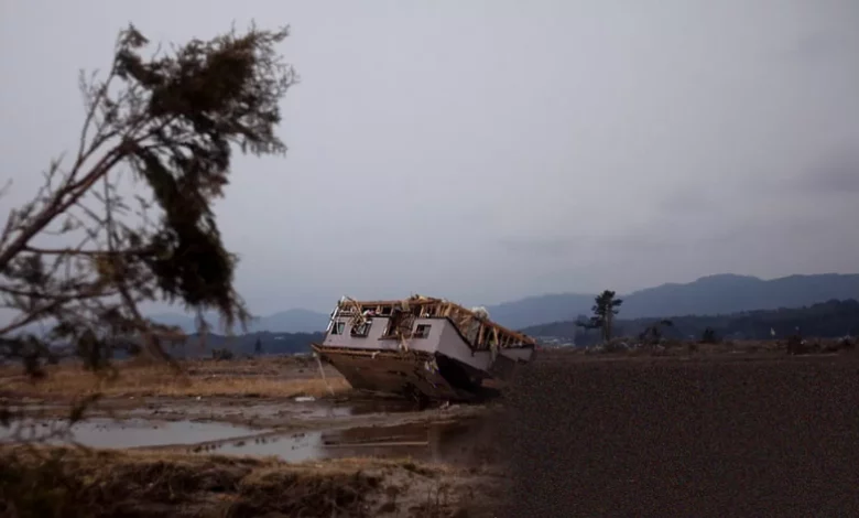
The findings revisit one of history’s most severe natural disasters. On March 11, 2011, a magnitude 9.0 earthquake—the Great East Japan Earthquake—triggered a massive tsunami that devastated the Pacific coast of the Tohoku region. The catastrophe killed nearly 20,000 people, with over 2,500 still officially missing 15 years on. Entire towns were erased, and over 400,000 people were displaced.
The earthquake also triggered the Fukushima Daiichi nuclear disaster, a Level 7 event on the International Nuclear and Radiological Event Scale. While no direct deaths from radiation sickness have been recorded, the health and well-being of over 150,000 evacuees were profoundly affected. Reconstruction in Tohoku has been extensive, but the legacy endures.
At the Fukushima Daiichi site, decommissioning continues. All four reactors involved were written off, with official ‘cold shutdown condition’ for the stricken Units 1-3 declared in December 2011. Japan reports discharge records and seawater monitoring results to the International Atomic Energy Agency (IAEA), which confirms the process is based on scientific evidence and international practice. Despite progress, 27,000 people from Fukushima Prefecture remain displaced.
Rethinking Risk and Resilience
In light of the mud-flow discovery, the researchers urge a fundamental update to how tsunami hazards are assessed. They recommend that risk evaluations explicitly account for the amplified danger posed by mud-rich coastal settings, such as deltas, estuaries, and agricultural land like the rice paddies of Tohoku.
This call aligns with broader, evolving efforts in coastal zone management. In Japan, this has historically involved strict land-use planning, with laws designating deeply flooding areas as non-habitable and relocating communities to higher ground, alongside defences like sea walls and sophisticated warning systems.
Globally, programs like the US National Tsunami Hazard Mitigation Program (NTHMP) focus on reducing impacts through preparedness, hazard assessment, and community planning initiatives such as “TsunamiReady”. Methodologies like Probabilistic Tsunami Hazard Assessment (PTHA) are vital, with research increasingly exploring tools like machine learning to improve complex numerical simulations.
The study underscores a growing recognition of the need for integrated coastal management that balances human use, ecological health, and disaster prevention—a lesson written in mud and borne on a deadly wave.