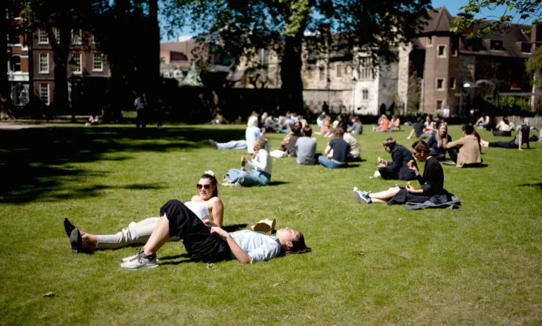
London was hotter than Majorca and the Algarve on Friday, with thermometers hitting a sizzling 25.4°C as the capital basked in a mini-heatwave. The Met Office recorded the high at both Heathrow Airport and Kew Gardens, making parts of southern England also hotter than Tenerife, where the projected peak was just 23°C. The mercury crept close to the year’s warmest day so far — 26.6°C at Kew Gardens on April 8 — but fell short of the all-time April record of 29.4°C, set in Camden Square, central London, in 1949.
The reason the capital and the South East are outperforming popular holiday destinations lies in the path of the warm air sweeping up from the south. Met Office meteorologist Simon Partridge explained: “We’ve got some very warm, humid air coming up from the south. That means we will see some very warm weather, particularly in the east and the South East, because there we’ll see the best of the sunshine.” While London enjoys bright skies, the rest of the country is not so lucky. Cloud straddling the central spine of the UK — from Scotland, through the Pennines and into the Midlands — is set to produce heavy rain on Friday, with the odd rumble of thunder. This contrast in conditions means that while the capital sizzles, other parts of Britain are wetter and cooler, and the same warm air that brings heat to the South East fails to reach the Mediterranean holiday spots that typically draw British sunseekers.

Bank holiday weekend outlook
The sunshine is not expected to last. Forecasters predict “unsettled conditions” and rain showers on the way over the May Day weekend. Saturday will bring bright spells but also showers, particularly across northern and western parts of the UK, where Scotland and Northern Ireland could see some heavy downpours. By Sunday, rain is forecast across much of England and Wales, with potential for heavier bursts and a small risk of thunderstorms, especially in the southeast. Southern Scotland may also see rain. Conditions are expected to improve on Monday, which is likely to be the driest day of the long weekend for many, though scattered showers remain possible in southern and central areas.
Mr Partridge warned the change will be noticeable: “There will be some bright spells in there as well on Saturday, but there will also be showers, particularly across northern and western parts of the UK. By the time we get to Monday, we’re actually going to see temperatures roughly where they should be for this time of year. We’re looking at elevens and twelves in the north and fifteens and sixteens in the south, so it will feel quite fresh and chilly compared to what we’ve had.” The Met Office has issued thunderstorm warnings for nine counties over the bank holiday weekend. Despite the warm air, the RNLI is advising caution at beaches because of the risk of cold water shock.

Long-term temperature comparisons
Friday’s high in the South East was about 10°C above the average for early May, which typically sits between 15°C and 17°C. The mini-heatwave follows an already warm April: April 8 saw the UK’s warmest early-April day in 80 years, and the month as a whole was provisionally drier and warmer than average for much of the country. Historically, April can produce dramatic swings — the lowest recorded April minimum temperature in the UK is -15.0°C, set in Newton Rigg, Cumbria, in 1917, and snow remains common on high ground in the month. Some commentators have suggested that recent heat events, including the April 2026 record, were made more likely by climate change, pointing to a pattern of “weather whiplash” where extremes such as storms and heatwaves rapidly alternate.

Looking ahead, Met Office long-range forecasts indicate a trend towards more changeable weather through May, with the possibility of low-pressure systems dominating and bringing showers or longer spells of rain, interspersed with drier intervals. Temperatures are expected to be close to or slightly below average at first, potentially returning to near normal or warmer later in the month. For now, the warmth has spurred a surge in bookings for outdoor activities such as paddleboarding, while pollen levels from ash and birch remain high due to the sunshine. The brief return to summer-like conditions, however, will be short-lived as the bank holiday weekend brings a distinctly cooler and wetter end to the week.